
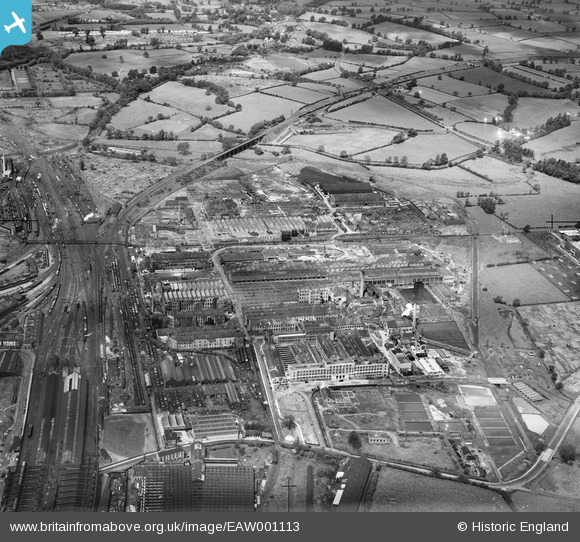
eaw001113 ENGLAND (1946). British Thomson-Houston Electrical Engineering Works, Rugby, 1946
© Copyright OpenStreetMap contributors and licensed by the OpenStreetMap Foundation. 2024. Cartography is licensed as CC BY-SA.
Nearby Images (28)
EAW001113

EAW001114

EAW001118

EAW001115

EAW001112

EAW001116

EAW000245

EAW000247

EPW028220

EAW000246

EPW028215

EPW028218

EAW001117

EAW000239

EPW033931

EPW028222

EPW028214

EPW028217

EAW000244

EPW010529

EPW028855

EPW028852

EAW000241

EPW028216

EPW028221

EAW000243

EPW001337

EAW000240

Details
| Title | [EAW001113] British Thomson-Houston Electrical Engineering Works, Rugby, 1946 |
| Reference | EAW001113 |
| Date | 20-June-1946 |
| Link | |
| Place name | RUGBY |
| Parish | |
| District | |
| Country | ENGLAND |
| Easting / Northing | 450731, 276377 |
| Longitude / Latitude | -1.2545759866521, 52.382692763651 |
| National Grid Reference | SP507764 |
Pins
 Matt Aldred edob.mattaldred.com |
Wednesday 6th of December 2023 02:13:39 PM | |
Matt Aldred edob.mattaldred.com |
Sunday 28th of February 2021 09:18:54 AM | |
Matt Aldred edob.mattaldred.com |
Sunday 28th of February 2021 09:18:47 AM | |
 cptpies |
Tuesday 30th of September 2014 09:41:35 AM | |
Anthony Appleyard |
Wednesday 23rd of October 2013 09:06:52 AM | |
Anthony Appleyard |
Wednesday 23rd of October 2013 09:05:25 AM | |
Anthony Appleyard |
Wednesday 23rd of October 2013 09:03:50 AM |
User Comment Contributions
 Pillbox at the entrance to the Thomson Electrical works. |
cptpies |
Tuesday 30th of September 2014 09:42:41 AM |


