
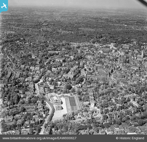
eaw000617 ENGLAND (1946). University College School, the surrounding residential area and Hampstead Heath, Hampstead, from the south, 1946
© Copyright OpenStreetMap contributors and licensed by the OpenStreetMap Foundation. 2024. Cartography is licensed as CC BY-SA.
Nearby Images (6)
EAW000617

EPW000812

EPW056665

EPW000817

EPW056658

EPW056653

Details
| Title | [EAW000617] University College School, the surrounding residential area and Hampstead Heath, Hampstead, from the south, 1946 |
| Reference | EAW000617 |
| Date | 10-May-1946 |
| Link | |
| Place name | HAMPSTEAD |
| Parish | |
| District | |
| Country | ENGLAND |
| Easting / Northing | 526255, 185456 |
| Longitude / Latitude | -0.1787258481403, 51.553367313665 |
| National Grid Reference | TQ263855 |
Pins
 Class31 |
Tuesday 19th of May 2015 07:45:07 AM |


