
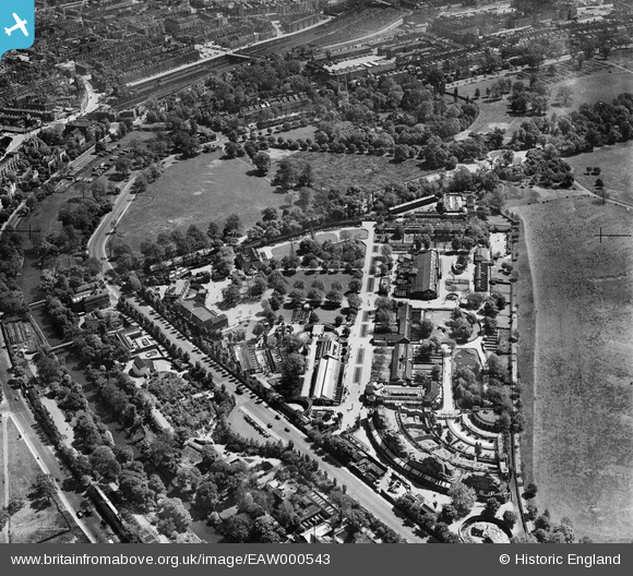
eaw000543 ENGLAND (1946). London Zoo, Regent's Park, 1946
© Copyright OpenStreetMap contributors and licensed by the OpenStreetMap Foundation. 2024. Cartography is licensed as CC BY-SA.
Nearby Images (12)
EAW000543

EAW030113

EAW015832

EAW030112

EPW046685

EAW000547

EAW000546

EPW005914

EPW027042

EPW006154

EAW000544

EPW009092

Details
| Title | [EAW000543] London Zoo, Regent's Park, 1946 |
| Reference | EAW000543 |
| Date | 9-May-1946 |
| Link | |
| Place name | REGENT'S PARK |
| Parish | |
| District | |
| Country | ENGLAND |
| Easting / Northing | 528200, 183410 |
| Longitude / Latitude | -0.15142964427028, 51.534539667655 |
| National Grid Reference | TQ282834 |
Pins
 John W |
Tuesday 15th of November 2016 06:11:54 PM | |
 Class31 |
Wednesday 2nd of December 2015 07:36:01 AM | |
Class31 |
Friday 1st of August 2014 07:29:58 AM | |
Class31 |
Friday 1st of August 2014 07:29:33 AM | |
Should read Prince Albert Road |
v6tek |
Wednesday 2nd of December 2015 05:59:44 AM |
Apologies for the mistake. |
Class31 |
Wednesday 2nd of December 2015 07:29:11 AM |
Class31 |
Friday 1st of August 2014 07:29:07 AM | |
 Alan McFaden |
Wednesday 26th of March 2014 10:16:20 AM |


