
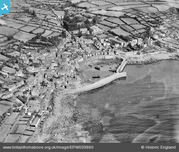
EPW039860 ENGLAND (1932). The harbour and the village, Mousehole, 1932
© Copyright OpenStreetMap contributors and licensed by the OpenStreetMap Foundation. 2025. Cartography is licensed as CC BY-SA.
Nearby Images (6)
EPW039860

EAW033637

EAW033638

EAW033639

EPW039858

EPW059871

Details
| Title | [EPW039860] The harbour and the village, Mousehole, 1932 |
| Reference | EPW039860 |
| Date | August-1932 |
| Link | |
| Place name | MOUSEHOLE |
| Parish | PENZANCE |
| District | |
| Country | ENGLAND |
| Easting / Northing | 146956, 26304 |
| Longitude / Latitude | -5.5375977497218, 50.082245292863 |
| National Grid Reference | SW470263 |
Pins
Be the first to add a comment to this image!