
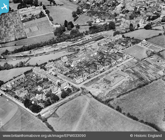
EPW033090 ENGLAND (1930). Westville, Kingsbridge, 1930
© Copyright OpenStreetMap contributors and licensed by the OpenStreetMap Foundation. 2024. Cartography is licensed as CC BY-SA.
Nearby Images (2)
EPW033090

EPW023737

Details
| Title | [EPW033090] Westville, Kingsbridge, 1930 |
| Reference | EPW033090 |
| Date | July-1930 |
| Link | |
| Place name | KINGSBRIDGE |
| Parish | KINGSBRIDGE |
| District | |
| Country | ENGLAND |
| Easting / Northing | 273134, 43945 |
| Longitude / Latitude | -3.7808432858309, 50.281196751648 |
| National Grid Reference | SX731439 |
Pins
 MB |
Saturday 27th of August 2016 10:27:59 AM | |
MB |
Saturday 27th of August 2016 10:27:13 AM | |
John W |
Friday 26th of August 2016 09:03:33 PM |


