
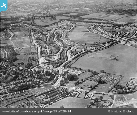
EPW028491 ENGLAND (1929). The London County Council Downham Estate, Downham, 1929
© Copyright OpenStreetMap contributors and licensed by the OpenStreetMap Foundation. 2024. Cartography is licensed as CC BY-SA.
Nearby Images (2)
EPW028491

EPW028058

Details
| Title | [EPW028491] The London County Council Downham Estate, Downham, 1929 |
| Reference | EPW028491 |
| Date | August-1929 |
| Link | |
| Place name | DOWNHAM |
| Parish | |
| District | |
| Country | ENGLAND |
| Easting / Northing | 539955, 171340 |
| Longitude / Latitude | 0.01317943908572, 51.423274802461 |
| National Grid Reference | TQ400713 |
Pins
 Diane |
Sunday 13th of April 2014 10:55:08 PM | |
Diane |
Sunday 13th of April 2014 10:54:28 PM | |
Diane |
Sunday 13th of April 2014 10:53:47 PM | |
lucky |
Wednesday 20th of November 2013 07:05:50 PM | |
Meant to say that Downham Boys and Downham Girls used this school as an annexe. |
lucky |
Wednesday 20th of November 2013 07:10:20 PM |
lucky |
Wednesday 20th of November 2013 06:27:14 PM | |
batesy |
Tuesday 1st of January 2013 12:34:00 PM | |
Chaz |
Wednesday 14th of November 2012 08:10:07 PM |
User Comment Contributions
This pub before it was demolished had the longest bar in Britain. |
batesy |
Tuesday 1st of January 2013 12:35:01 PM |


