
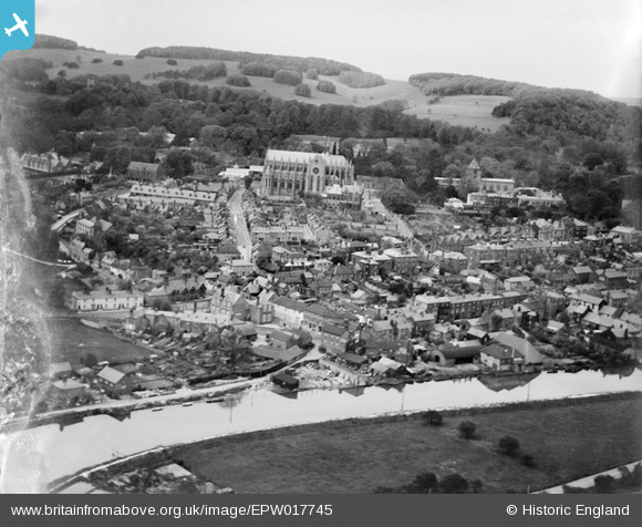
EPW017745 ENGLAND (1927). St Philip Neri's Roman Catholic Church and the town centre, Arundel, from the south, 1927
© Copyright OpenStreetMap contributors and licensed by the OpenStreetMap Foundation. 2024. Cartography is licensed as CC BY-SA.
Nearby Images (7)
EPW017745

EPW000727

EAW021576

EAW021575

EPW000689

EPW000762

EPW018260

Details
| Title | [EPW017745] St Philip Neri's Roman Catholic Church and the town centre, Arundel, from the south, 1927 |
| Reference | EPW017745 |
| Date | April-1927 |
| Link | |
| Place name | ARUNDEL |
| Parish | ARUNDEL |
| District | |
| Country | ENGLAND |
| Easting / Northing | 501525, 106957 |
| Longitude / Latitude | -0.55754276507654, 50.852650113494 |
| National Grid Reference | TQ015070 |
Pins
 Alan McFaden |
Sunday 18th of May 2014 07:17:57 PM | |
Alan McFaden |
Sunday 18th of May 2014 07:17:30 PM |


