
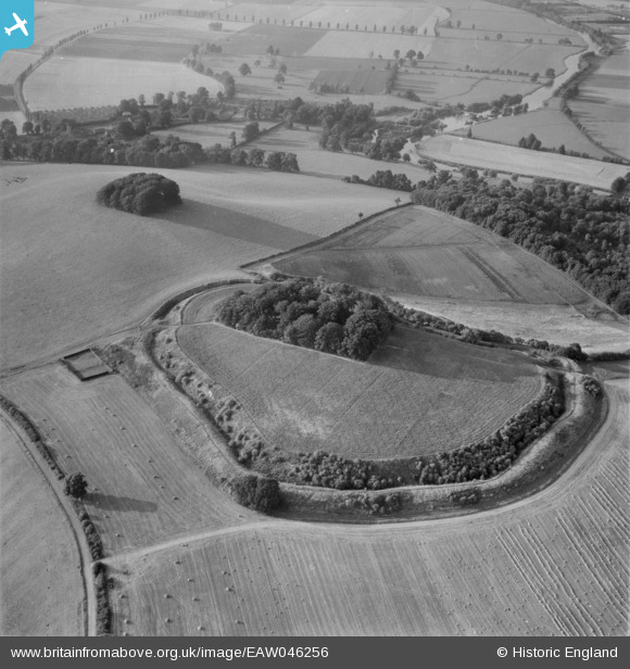
EAW046256 ENGLAND (1952). Castle Hill (Sinodun Hill Camp), Wittenham Clumps, 1952
© Copyright OpenStreetMap contributors and licensed by the OpenStreetMap Foundation. 2024. Cartography is licensed as CC BY-SA.
Nearby Images (3)
EAW046256
, Wittenham Clumps, 1952")
EAW046258
, Wittenham Clumps, 1952")
EAW046257
 and Little Wittenham Wood, Wittenham Clumps, 1952")
Details
| Title | [EAW046256] Castle Hill (Sinodun Hill Camp), Wittenham Clumps, 1952 |
| Reference | EAW046256 |
| Date | 25-August-1952 |
| Link | |
| Place name | WITTENHAM CLUMPS |
| Parish | LITTLE WITTENHAM |
| District | |
| Country | ENGLAND |
| Easting / Northing | 456914, 192477 |
| Longitude / Latitude | -1.1776776871388, 51.62775764884 |
| National Grid Reference | SU569925 |
Pins
Be the first to add a comment to this image!


