
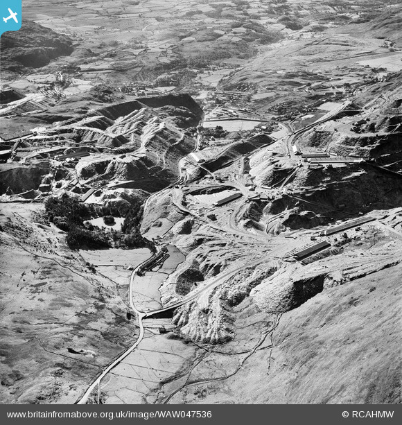
waw047536 WALES (1952). View of Madoc quarry, Blaenau Ffestiniog, commissioned by Cawood Wharton & Co. Ltd.
© Copyright OpenStreetMap contributors and licensed by the OpenStreetMap Foundation. 2024. Cartography is licensed as CC BY-SA.
Nearby Images (25)
WAW047534

WAW047535

WAW047536

WAW047537

WAW047538

WAW047539

WAW047540

WAW047541

WAW047542

WAW047543

WAW047544

WAW047545

WAW047546

WAW050254

WAW050255

WAW050256

WAW050257

WAW050258

WAW050259

WAW050260

WAW050261

WAW050262

WAW050263

WAW050264

WAW050265

Details
| Title | [WAW047536] View of Madoc quarry, Blaenau Ffestiniog, commissioned by Cawood Wharton & Co. Ltd. |
| Reference | WAW047536 |
| Date | 1952 |
| Link | Coflein Archive Item 6414611 |
| Place name | |
| Parish | |
| District | |
| Country | WALES |
| Easting / Northing | 270818, 344704 |
| Longitude / Latitude | -3.924481826973, 52.983773481062 |
| National Grid Reference | SH708447 |
Pins
 DaveH |
Monday 4th of May 2020 11:50:23 PM | |
DaveH |
Monday 4th of May 2020 11:47:12 PM | |
 Class31 |
Saturday 17th of May 2014 11:36:44 AM | |
Class31 |
Saturday 17th of May 2014 11:29:58 AM | |
Class31 |
Saturday 17th of May 2014 11:19:24 AM |
User Comment Contributions
From the north. |
Class31 |
Saturday 17th of May 2014 11:30:24 AM |


