
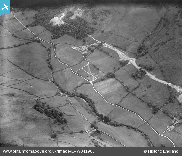
epw041963 ENGLAND (1933). The Haweswater Aqueduct under construction near Low House, Longsleddale, 1933
© Copyright OpenStreetMap contributors and licensed by the OpenStreetMap Foundation. 2024. Cartography is licensed as CC BY-SA.
Nearby Images (5)
EPW041963

EPW041971

EPW041944

EPW048579

EPW041948

Details
| Title | [EPW041963] The Haweswater Aqueduct under construction near Low House, Longsleddale, 1933 |
| Reference | EPW041963 |
| Date | June-1933 |
| Link | |
| Place name | LONGSLEDDALE |
| Parish | LONGSLEDDALE |
| District | |
| Country | ENGLAND |
| Easting / Northing | 351184, 501108 |
| Longitude / Latitude | -2.7520797536138, 54.402948353372 |
| National Grid Reference | NY512011 |
Pins
Be the first to add a comment to this image!


