
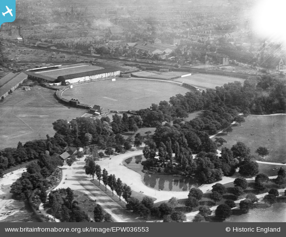
epw036553 ENGLAND (1931). West Park, the Circle Cricket Ground and adjacent Hull City Football Stadium, Kingston upon Hull, 1931
© Copyright OpenStreetMap contributors and licensed by the OpenStreetMap Foundation. 2024. Cartography is licensed as CC BY-SA.
Nearby Images (7)
EPW036553

EPW012816

EPW036552

EPW036391

EPW036556

EPW012821

EPW036568

Details
| Title | [EPW036553] West Park, the Circle Cricket Ground and adjacent Hull City Football Stadium, Kingston upon Hull, 1931 |
| Reference | EPW036553 |
| Date | August-1931 |
| Link | |
| Place name | KINGSTON UPON HULL |
| Parish | |
| District | |
| Country | ENGLAND |
| Easting / Northing | 507702, 428962 |
| Longitude / Latitude | -0.36665187707918, 53.745669986006 |
| National Grid Reference | TA077290 |
Pins
 John Wass |
Tuesday 24th of June 2014 03:18:18 PM |


