
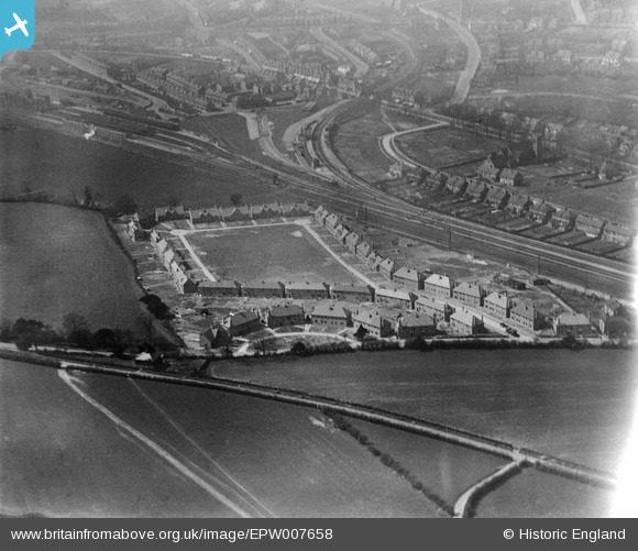
epw007658 ENGLAND (1922). Stoats Nest Village and environs, Coulsdon, 1922
© Copyright OpenStreetMap contributors and licensed by the OpenStreetMap Foundation. 2024. Cartography is licensed as CC BY-SA.
Nearby Images (3)
EPW007658

EPW007659

EPW007657

Details
| Title | [EPW007658] Stoats Nest Village and environs, Coulsdon, 1922 |
| Reference | EPW007658 |
| Date | 19-April-1922 |
| Link | |
| Place name | COULSDON |
| Parish | |
| District | |
| Country | ENGLAND |
| Easting / Northing | 530372, 159829 |
| Longitude / Latitude | -0.12880858405638, 51.322100973406 |
| National Grid Reference | TQ304598 |
Pins
 Dom |
Monday 20th of April 2020 02:15:12 PM | |
Rob |
Wednesday 22nd of October 2014 09:46:13 PM | |
Rob |
Wednesday 22nd of October 2014 09:44:32 PM | |
Rob |
Wednesday 22nd of October 2014 09:42:59 PM | |
Rob |
Wednesday 22nd of October 2014 09:40:34 PM |
User Comment Contributions
Brighton Road (A23) |
Rob |
Wednesday 22nd of October 2014 09:41:38 PM |


