
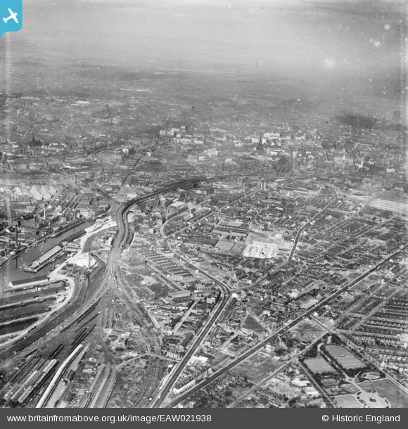
eaw021938 ENGLAND (1949). The city of Manchester, Old Trafford, from the south-west, 1949
© Copyright OpenStreetMap contributors and licensed by the OpenStreetMap Foundation. 2024. Cartography is licensed as CC BY-SA.
Details
| Title | [EAW021938] The city of Manchester, Old Trafford, from the south-west, 1949 |
| Reference | EAW021938 |
| Date | 9-April-1949 |
| Link | |
| Place name | OLD TRAFFORD |
| Parish | |
| District | |
| Country | ENGLAND |
| Easting / Northing | 382352, 396644 |
| Longitude / Latitude | -2.2658667418943, 53.465987491049 |
| National Grid Reference | SJ824966 |
Pins
 Stretfordian |
Wednesday 30th of August 2017 07:06:29 PM | |
Stretfordian |
Wednesday 30th of August 2017 07:04:45 PM | |
Stretfordian |
Wednesday 30th of August 2017 07:03:28 PM | |
Stretfordian |
Wednesday 30th of August 2017 07:00:18 PM | |
Stretfordian |
Wednesday 30th of August 2017 06:56:16 PM | |
Stretfordian |
Wednesday 30th of August 2017 06:54:36 PM | |
Chrissy_R |
Saturday 31st of December 2016 05:13:32 AM | |
Chrissy_R |
Saturday 31st of December 2016 05:09:03 AM | |
Chrissy_R |
Saturday 31st of December 2016 05:03:28 AM | |
Chrissy_R |
Saturday 31st of December 2016 05:02:40 AM | |
Chrissy_R |
Saturday 31st of December 2016 05:01:20 AM | |
Chrissy_R |
Saturday 31st of December 2016 05:00:02 AM |


