
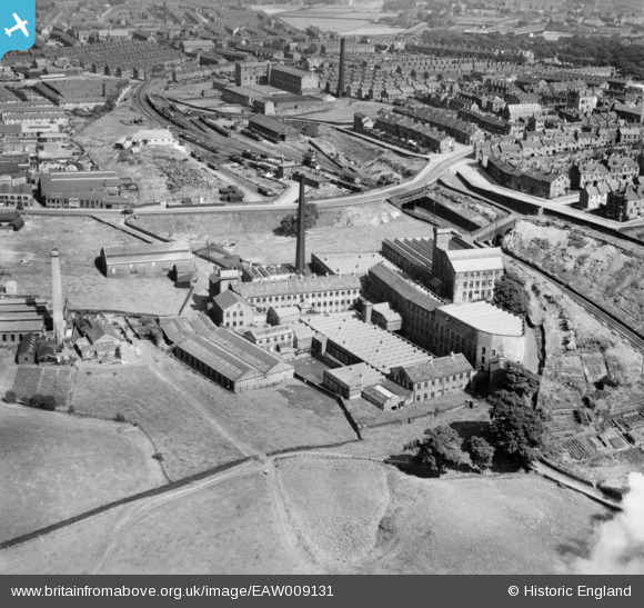
eaw009131 ENGLAND (1947). Beckside Worsted Mills at Great Horton, Bradford, 1947
© Copyright OpenStreetMap contributors and licensed by the OpenStreetMap Foundation. 2024. Cartography is licensed as CC BY-SA.
Nearby Images (12)
EAW009131

EAW009136

EAW009128

EAW009132

EAW009130

EAW009133

EAW009129

EAW009134

EAW009137

EAW009135

EPW024410

EPW052161

Details
| Title | [EAW009131] Beckside Worsted Mills at Great Horton, Bradford, 1947 |
| Reference | EAW009131 |
| Date | 15-August-1947 |
| Link | |
| Place name | BRADFORD |
| Parish | |
| District | |
| Country | ENGLAND |
| Easting / Northing | 414046, 431884 |
| Longitude / Latitude | -1.7868063643238, 53.782875740473 |
| National Grid Reference | SE140319 |
Pins
 nazman |
Monday 23rd of January 2017 10:39:28 PM | |
nazman |
Monday 23rd of January 2017 10:36:47 PM | |
H.J.Hill |
Monday 25th of August 2014 12:09:00 PM | |
H.J.Hill |
Monday 25th of August 2014 12:07:55 PM | |
H.J.Hill |
Monday 25th of August 2014 12:06:27 PM | |
H.J.Hill |
Monday 25th of August 2014 12:04:05 PM | |
H.J.Hill |
Monday 18th of November 2013 07:59:27 PM | |
H.J.Hill |
Monday 18th of November 2013 07:57:52 PM | |
H.J.Hill |
Monday 18th of November 2013 07:57:09 PM | |
H.J.Hill |
Monday 18th of November 2013 07:55:03 PM |


