
WPW041792 WALES (1933). View of Cardiff Railway Station, oblique aerial view. 5"x4" black and white glass plate negative.

© Copyright OpenStreetMap contributors and licensed by the OpenStreetMap Foundation. 2024. Cartography is licensed as CC BY-SA.
Nearby Images (48)
WPW001000

WPW001001

WPW001002

WPW001003

WPW001004

WPW001008

WPW001009

WPW001010

WPW001014

WPW001035

WPW016914

WPW016915

WPW016916

WPW016917

WPW016918

WPW016919

WPW016920

WPW029422

WPW029423

WPW029424

WPW029425

WPW029427

WPW029429

WPW041787

WPW041788

WPW041789

WPW041790

WPW041791

WPW041792

WPW041793

WPW041794

WPW041795

WPW052624

WPW052659

WPW052660

WPW052661

WPW052662

WPW052663

WPW052664

WPW054861

WPW054863

WPW054864

WPW054865

WPW055450

WPW055451

WPW055452

WPW055453

WPW055454

Details
| Title | [WPW041792] View of Cardiff Railway Station, oblique aerial view. 5"x4" black and white glass plate negative. |
| Reference | WPW041792 |
| Date | 1933 |
| Link | Coflein Archive Item 6369792 |
| Place name | |
| Parish | |
| District | |
| Country | WALES |
| Easting / Northing | 318170, 176360 |
| Longitude / Latitude | -3.1785006478589, 51.479784917149 |
| National Grid Reference | ST182764 |
Pins
 XYZOE |
Saturday 6th of August 2022 09:35:34 PM | |
Mattibach |
Wednesday 17th of February 2021 05:13:11 PM | |
poked |
Friday 15th of November 2013 12:13:50 PM | |
 BillySastard |
Thursday 9th of May 2013 02:07:25 PM | |
 Class31 |
Sunday 7th of October 2012 08:23:21 AM | |
kent2 |
Sunday 7th of October 2012 12:17:20 AM | |
Allan |
Tuesday 31st of July 2012 05:51:27 PM | |
Allan |
Tuesday 31st of July 2012 05:50:32 PM | |
Allan |
Tuesday 31st of July 2012 05:49:16 PM | |
Class31 |
Monday 2nd of July 2012 04:26:35 PM | |
Class31 |
Monday 2nd of July 2012 04:21:34 PM | |
BillySastard |
Wednesday 27th of June 2012 04:51:31 AM | |
 |
BillySastard |
Wednesday 27th of June 2012 04:01:36 AM |
BillySastard |
Tuesday 26th of June 2012 12:27:06 AM | |
At time of photograph this was Cardiff General, the name change to Central came in 1973. Platform 5 was a terminal bay, long infilled. Anybody know when ? |
gBr |
Sunday 8th of November 2015 10:37:44 PM |
BillySastard |
Tuesday 26th of June 2012 12:24:41 AM | |
Riverside station had two side platforms, this shows the situation after rebuilding as an island, at which time it was incorporated into Cardiff General as platforms 8 & 9. |
gBr |
Sunday 8th of November 2015 10:32:54 PM |
User Comment Contributions
 16.21hrs to Chester, Cardiff, 14/10/2014 |
Class31 |
Wednesday 15th of October 2014 09:03:50 AM |
 Recent view east on Platform 7. |
Class31 |
Sunday 23rd of June 2013 12:41:30 PM |
 Recent view west on Platform 7. |
Class31 |
Sunday 23rd of June 2013 12:39:36 PM |
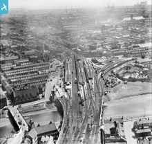 Cardiff Central Railway Station including platform 5 and adjacent Riverside Railway Station. Also Cardiff bus station site on Wood Street |
BillySastard |
Tuesday 16th of October 2012 03:13:10 AM |
to the left of cardiff general is the temperance town slums |
daveinnola |
Tuesday 16th of October 2012 03:13:10 AM |
This view works well with Google Earth if you manouvre it to the same height etc.The Huge Stadium where the Temperance Houses were.I bet it is not dry now! The riverside rail tracks no longer shown all clear to see in the comparison. |
The G.R.E.S.Railways from the air |
Wednesday 4th of July 2012 10:49:07 PM |
This picture is probably from 1932 as the station building appears to be under construction and I believe there's an inscription on the building saying it was completed in 1932. |
MikeW |
Wednesday 27th of June 2012 03:32:47 PM |
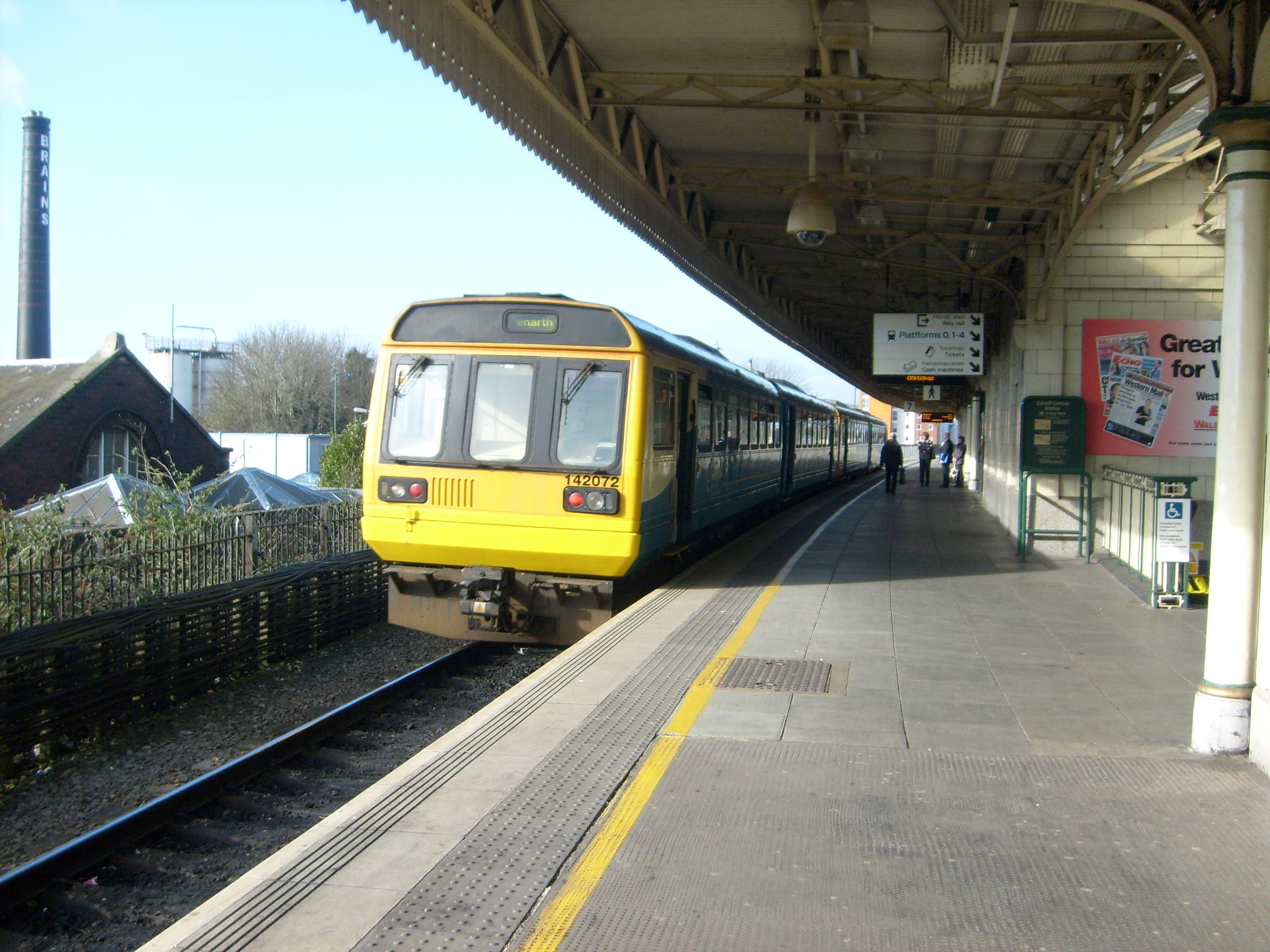
Cardiff Central Railway Station |
BillySastard |
Wednesday 27th of June 2012 03:42:00 AM |


