
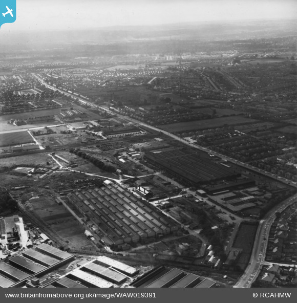
WAW019391 WALES (1948). General view of factories and government buildings including the RO factory and new Inland Revenue buildings at Llanishen. Oblique aerial photograph, 5½" cut roll film.
© Copyright OpenStreetMap contributors and licensed by the OpenStreetMap Foundation. 2024. Cartography is licensed as CC BY-SA.
Nearby Images (7)
WAW019391

WAW019392

WAW019393

WAW019394

WAW019395

WAW019396

WAW019399

Details
| Title | [WAW019391] General view of factories and government buildings including the RO factory and new Inland Revenue buildings at Llanishen. Oblique aerial photograph, 5½" cut roll film. |
| Reference | WAW019391 |
| Date | 30-September-1948 |
| Link | Coflein Archive Item 6423369 |
| Place name | |
| Parish | |
| District | |
| Country | WALES |
| Easting / Northing | 317590, 181810 |
| Longitude / Latitude | -3.1881255318426, 51.528699283558 |
| National Grid Reference | ST176818 |
Pins
Be the first to add a comment to this image!
User Comment Contributions
The placing of the pins for this series of photo's is confusing when trying to orientate the location. They should be placed near to or alongside those showing Morgan Rees at Birchgrove, a little lower down on the map. |
 Nowy Paul |
Sunday 5th of March 2017 03:33:35 PM |


