
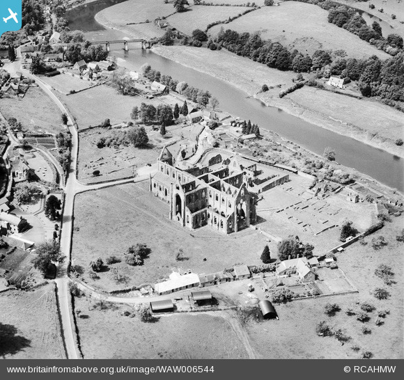
WAW006544 WALES (1947). View of Tintern Abbey
© Copyright OpenStreetMap contributors and licensed by the OpenStreetMap Foundation. 2024. Cartography is licensed as CC BY-SA.
Nearby Images (17)
WAW006540

WAW006541

WAW006542

WAW006543

WAW006544

WAW006545

WAW007090

WAW007091

WAW007092

WAW007093

WAW007094

WAW007095

WAW007096

WAW007097

WAW007098

WAW017495

WPW006064

Details
| Title | [WAW006544] View of Tintern Abbey |
| Reference | WAW006544 |
| Date | 31-May-1947 |
| Link | Coflein Archive Item 6413411 |
| Place name | |
| Parish | |
| District | |
| Country | WALES |
| Easting / Northing | 353310, 199990 |
| Longitude / Latitude | -2.6756170098079, 51.696253341799 |
| National Grid Reference | ST5331000 |
Pins
 MB |
Friday 16th of May 2014 10:20:16 PM | |
MB |
Friday 16th of May 2014 10:19:46 PM | |
MB |
Friday 16th of May 2014 10:18:39 PM | |
MB |
Friday 16th of May 2014 10:17:00 PM | |
MB |
Friday 16th of May 2014 10:15:11 PM | |
 Class31 |
Monday 28th of April 2014 12:00:36 PM |
User Comment Contributions
 Tintern Abbey, 30/05/2016 |
Class31 |
Saturday 4th of June 2016 09:03:03 AM |


