
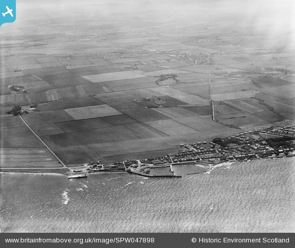
SPW047898 SCOTLAND (1935). Aerodrome, Port Seton. An oblique aerial photograph taken facing south.
© Copyright OpenStreetMap contributors and licensed by the OpenStreetMap Foundation. 2024. Cartography is licensed as CC BY-SA.
Nearby Images (3)
SPW047898

SAW010722

SAR031686

Details
| Title | [SPW047898] Aerodrome, Port Seton. An oblique aerial photograph taken facing south. |
| Reference | SPW047898 |
| Date | 1935 |
| Link | Canmore Collection item 1259463 |
| Place name | |
| Parish | TRANENT |
| District | EAST LOTHIAN |
| Country | SCOTLAND |
| Easting / Northing | 340487, 675947 |
| Longitude / Latitude | -2.9536670657854, 55.972868695569 |
| National Grid Reference | NT405759 |
Pins
 Andy A |
Friday 12th of January 2018 12:52:37 AM | |
Andy A |
Monday 6th of January 2014 12:47:37 PM | |
Andy A |
Monday 6th of January 2014 12:46:17 PM | |
Andy A |
Monday 6th of January 2014 12:45:51 PM | |
Andy A |
Monday 6th of January 2014 12:39:52 PM | |
MB |
Monday 3rd of December 2012 10:27:57 AM |


