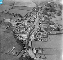
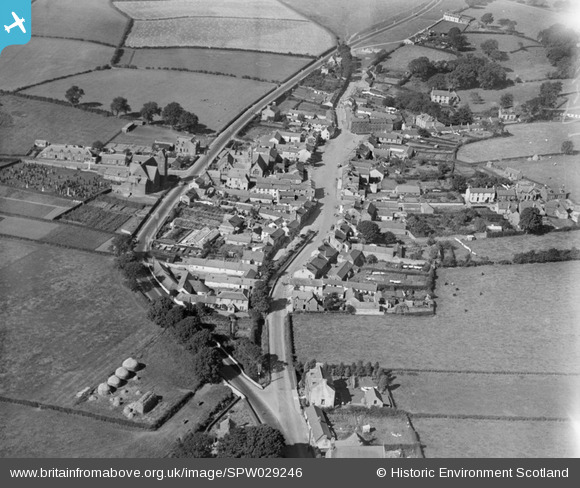
SPW029246 SCOTLAND (1929). Ecclefechan, general view, showing High Street and Johnstone United Presbyterian Church. An oblique aerial photograph taken facing west.
© Copyright OpenStreetMap contributors and licensed by the OpenStreetMap Foundation. 2024. Cartography is licensed as CC BY-SA.
Nearby Images (4)
SPW029246

SPW029245

SPW029247

SPW029244

Details
| Title | [SPW029246] Ecclefechan, general view, showing High Street and Johnstone United Presbyterian Church. An oblique aerial photograph taken facing west. |
| Reference | SPW029246 |
| Date | 1929 |
| Link | Canmore Collection item 1256916 |
| Place name | |
| Parish | HODDOM |
| District | ANNANDALE AND ESKDALE |
| Country | SCOTLAND |
| Easting / Northing | 319364, 574604 |
| Longitude / Latitude | -3.262576954665, 55.059297671632 |
| National Grid Reference | NY194746 |
Pins
 Class31 |
Monday 4th of March 2013 04:47:54 PM | |
Class31 |
Monday 4th of March 2013 04:36:45 PM | |
There are some details on this memorial at www.ukniwm.org.uk/server/show/conMemorial.44124/fromUkniwmSearch/1, but there are not (yet) any names of the soldiers. |
 melgibbs |
Monday 30th of December 2013 06:49:46 PM |
Class31 |
Monday 4th of March 2013 04:34:54 PM | |
Alternative name is Johnstone United Presbyterian Church |
Class31 |
Monday 4th of March 2013 04:42:20 PM |