
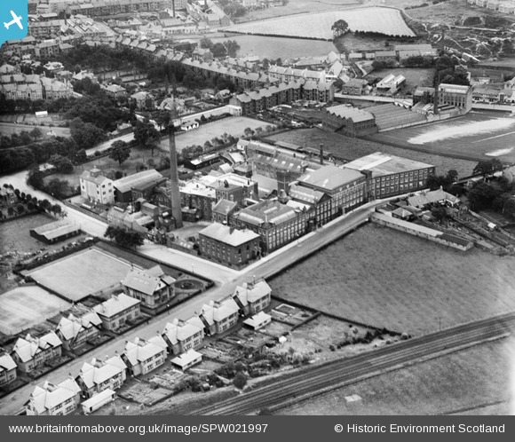
SPW021997 SCOTLAND (1928). Brown and Polson's Starch Works, Falside Road, Paisley. An oblique aerial photograph taken facing north-east.
© Copyright OpenStreetMap contributors and licensed by the OpenStreetMap Foundation. 2024. Cartography is licensed as CC BY-SA.
Nearby Images (4)
SPW021994

SPW021995

SPW021996

SPW021997

Details
| Title | [SPW021997] Brown and Polson's Starch Works, Falside Road, Paisley. An oblique aerial photograph taken facing north-east. |
| Reference | SPW021997 |
| Date | 1928 |
| Link | Canmore Collection item 1256415 |
| Place name | |
| Parish | PAISLEY (RENFREW) |
| District | RENFREW |
| Country | SCOTLAND |
| Easting / Northing | 248091, 662258 |
| Longitude / Latitude | -4.4255406827426, 55.829637966465 |
| National Grid Reference | NS481623 |
Pins
 eric144 |
Tuesday 7th of January 2020 06:39:35 AM | |
brodie93 |
Wednesday 28th of January 2015 09:53:49 PM | |
brodie93 |
Wednesday 28th of January 2015 09:50:46 PM | |
brodie93 |
Wednesday 28th of January 2015 09:45:07 PM | |
brodie93 |
Thursday 22nd of January 2015 10:38:51 PM | |
Dave Wilson |
Saturday 2nd of August 2014 12:03:51 PM | |
bossjock |
Sunday 9th of June 2013 02:10:53 PM | |
 Paul Cochrane |
Sunday 28th of October 2012 07:10:40 PM | |
bossjock |
Friday 19th of October 2012 05:03:36 PM | |
bossjock |
Friday 19th of October 2012 04:48:40 PM | |
jimmy |
Wednesday 29th of August 2012 04:18:56 PM | |
jimmy |
Wednesday 29th of August 2012 04:17:50 PM | |
jimmy |
Wednesday 29th of August 2012 04:17:18 PM | |
jimmy |
Wednesday 29th of August 2012 04:16:12 PM | |
jimmy |
Wednesday 29th of August 2012 04:14:57 PM | |
jimmy |
Wednesday 29th of August 2012 04:13:34 PM | |
jimmy |
Wednesday 29th of August 2012 04:12:50 PM |


