
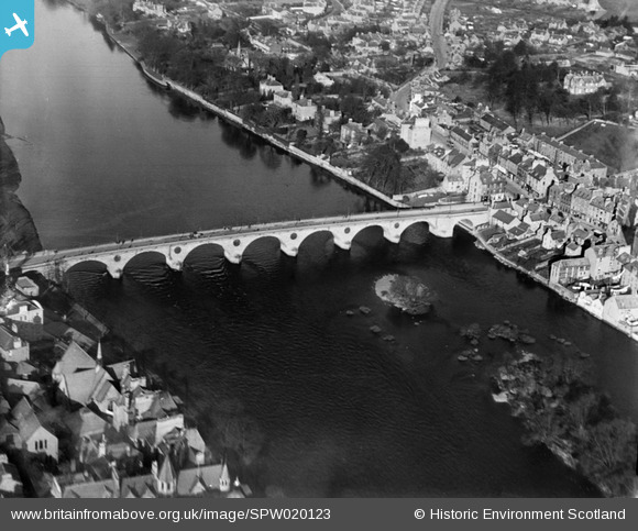
SPW020123 SCOTLAND (1927). Perth Bridge. An oblique aerial photograph taken facing north.
© Copyright OpenStreetMap contributors and licensed by the OpenStreetMap Foundation. 2024. Cartography is licensed as CC BY-SA.
Nearby Images (5)
SPW020117

SPW020123

SAR018932

SAR018933

SAW026585

Details
| Title | [SPW020123] Perth Bridge. An oblique aerial photograph taken facing north. |
| Reference | SPW020123 |
| Date | 1927 |
| Link | Canmore Collection item 1246416 |
| Place name | |
| Parish | PERTH |
| District | PERTH AND KINROSS |
| Country | SCOTLAND |
| Easting / Northing | 312123, 723885 |
| Longitude / Latitude | -3.4239144821687, 56.399129908987 |
| National Grid Reference | NO121239 |


