
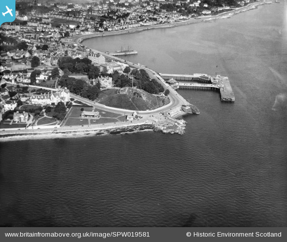
SPW019581 SCOTLAND (1927). Dunoon, general view, showing Dunoon Castle, and Pier Esplanade. An oblique aerial photograph taken facing north.
© Copyright OpenStreetMap contributors and licensed by the OpenStreetMap Foundation. 2024. Cartography is licensed as CC BY-SA.
Nearby Images (4)
SPW019581

SPW019582

SAR016599

SAR016600

Details
| Title | [SPW019581] Dunoon, general view, showing Dunoon Castle, and Pier Esplanade. An oblique aerial photograph taken facing north. |
| Reference | SPW019581 |
| Date | 1927 |
| Link | Canmore Collection item 1256153 |
| Place name | |
| Parish | DUNOON AND KILMUN |
| District | ARGYLL AND BUTE |
| Country | SCOTLAND |
| Easting / Northing | 217509, 676383 |
| Longitude / Latitude | -4.9227126944148, 55.945810822033 |
| National Grid Reference | NS175764 |
Pins
Be the first to add a comment to this image!
User Comment Contributions
 The first stone castle was built here in the 1200s. It became a royal castle in 1377. |
 Cat |
Tuesday 23rd of September 2014 07:12:49 AM |


