
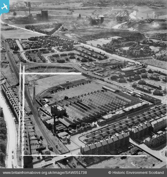
SAW051738 SCOTLAND (1953). Glasgow, general view, showing Macfarlane, Lang and Co. Victoria Biscuit Works, Clydeford Drive and Clyde Iron Works. An oblique aerial photograph taken facing south. This image has been produced from a crop marked negative.
© Copyright OpenStreetMap contributors and licensed by the OpenStreetMap Foundation. 2024. Cartography is licensed as CC BY-SA.
Nearby Images (18)
SAW051738

SAW051740

SAW051744

SPW027232

SPW027233

SPW027234

SPW027235

SPW027236

SPW027237

SPW027238

SPW027239

SAW035573

SPW027255

SPW027256

SAW051741

SAW051742

SAW051743

SAW051745

Details
| Title | [SAW051738] Glasgow, general view, showing Macfarlane, Lang and Co. Victoria Biscuit Works, Clydeford Drive and Clyde Iron Works. An oblique aerial photograph taken facing south. This image has been produced from a crop marked negative. |
| Reference | SAW051738 |
| Date | 1953 |
| Link | Canmore Collection item 1297966 |
| Place name | |
| Parish | GLASGOW (CITY OF GLASGOW) |
| District | CITY OF GLASGOW |
| Country | SCOTLAND |
| Easting / Northing | 263160, 663450 |
| Longitude / Latitude | -4.1857410332151, 55.844848162765 |
| National Grid Reference | NS632635 |
Pins
 ianross |
Monday 9th of October 2017 02:43:36 PM | |
 Class31 |
Friday 30th of November 2012 08:53:51 PM | |
Class31 |
Friday 30th of November 2012 08:41:44 PM | |
Class31 |
Friday 30th of November 2012 08:41:20 PM | |
Class31 |
Friday 30th of November 2012 08:39:41 PM | |
Class31 |
Friday 30th of November 2012 08:39:02 PM |


