
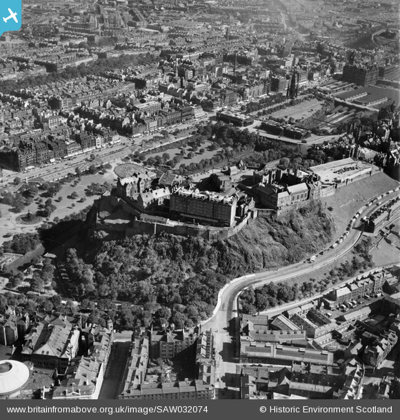
SAW032074 SCOTLAND (1950). Edinburgh, general view, showing Edinburgh Castle and Princes Street. An oblique aerial photograph taken facing north-east.
© Copyright OpenStreetMap contributors and licensed by the OpenStreetMap Foundation. 2024. Cartography is licensed as CC BY-SA.
Nearby Images (27)
SAW032074

SAR010385

SAR010386

SAR010458

SAR011155

SAR033373

SAR033375

SAR033376

SAW014850

SAW014851

SAW036195

SAW036196

SPW017703

SAW032075

SPW027331

SAW032076

SPW027332

SPW040195

SAW032077

SPW027131

SPW027132

SAW009821

SAW010251

SAW010253

SAW010260

SPW040193

SPW027330

Details
| Title | [SAW032074] Edinburgh, general view, showing Edinburgh Castle and Princes Street. An oblique aerial photograph taken facing north-east. |
| Reference | SAW032074 |
| Date | 1950 |
| Link | Canmore Collection item 1269665 |
| Place name | |
| Parish | EDINBURGH (EDINBURGH, CITY OF) |
| District | CITY OF EDINBURGH |
| Country | SCOTLAND |
| Easting / Northing | 325068, 673477 |
| Longitude / Latitude | -3.2000075069218, 55.948519970836 |
| National Grid Reference | NT251735 |
Pins
 gBr |
Friday 13th of May 2022 10:20:15 PM | |
gBr |
Sunday 30th of June 2019 09:16:45 PM | |
Britain from Above |
Wednesday 9th of August 2017 10:07:25 AM | |
ht247 |
Saturday 11th of October 2014 11:08:21 PM | |
Bill M |
Tuesday 26th of June 2012 08:46:23 PM |


