
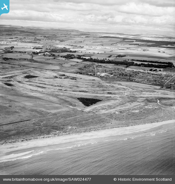
SAW024477 SCOTLAND (1949). Carnoustie Golf Courses and Anderson-Grice Co. Ltd. Taymouth Engineering Works, Anderson Street, Carnoustie. An oblique aerial photograph taken facing north-west.
© Copyright OpenStreetMap contributors and licensed by the OpenStreetMap Foundation. 2024. Cartography is licensed as CC BY-SA.
Nearby Images (3)
SAW024476

SAW024477

SPW019957

Details
| Title | [SAW024477] Carnoustie Golf Courses and Anderson-Grice Co. Ltd. Taymouth Engineering Works, Anderson Street, Carnoustie. An oblique aerial photograph taken facing north-west. |
| Reference | SAW024477 |
| Date | 1949 |
| Link | Canmore Collection item 1269322 |
| Place name | |
| Parish | BARRY |
| District | ANGUS |
| Country | SCOTLAND |
| Easting / Northing | 355322, 733953 |
| Longitude / Latitude | -2.7257557041397, 56.495644478841 |
| National Grid Reference | NO553340 |
Pins
 Matt Aldred edob.mattaldred.com |
Thursday 4th of March 2021 02:27:53 PM | |
Matt Aldred edob.mattaldred.com |
Thursday 4th of March 2021 02:27:39 PM | |
Matt Aldred edob.mattaldred.com |
Thursday 4th of March 2021 02:27:26 PM | |
 cptpies |
Wednesday 8th of April 2015 11:43:48 AM | |
cptpies |
Wednesday 8th of April 2015 11:43:29 AM | |
jrussill |
Thursday 5th of February 2015 02:57:46 PM | |
royalfixit |
Thursday 28th of June 2012 05:24:32 PM |
User Comment Contributions
 WW2 Anti Tank Blocks |
jrussill |
Thursday 5th of February 2015 03:09:55 PM |
The first official golf club was founded in 1842, playing over ten holes. Old Tom Morris extended the links to 18 holes in 1857 and the last major revision was undertaken by James Braid in 1926. |
royalfixit |
Thursday 28th of June 2012 05:26:41 PM |


