
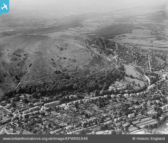
EPW061948 ENGLAND (1939). North Hill, Great Malvern, 1939
© Copyright OpenStreetMap contributors and licensed by the OpenStreetMap Foundation. 2024. Cartography is licensed as CC BY-SA.
Nearby Images (2)
EPW061948

EPW061947

Details
| Title | [EPW061948] North Hill, Great Malvern, 1939 |
| Reference | EPW061948 |
| Date | 8-June-1939 |
| Link | |
| Place name | GREAT MALVERN |
| Parish | MALVERN |
| District | |
| Country | ENGLAND |
| Easting / Northing | 377336, 246486 |
| Longitude / Latitude | -2.3310228953244, 52.115817835445 |
| National Grid Reference | SO773465 |
Pins
 Tony Black |
Tuesday 25th of February 2020 02:07:25 PM | |
 BobE |
Monday 3rd of March 2014 10:53:50 AM | |
Cowshed |
Friday 15th of November 2013 10:09:51 PM | |
Cowshed |
Friday 15th of November 2013 10:09:21 PM |


