
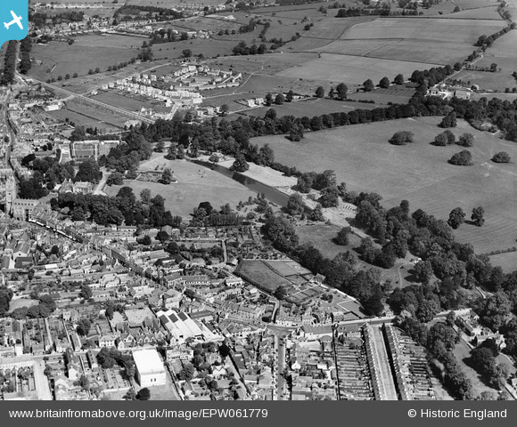
EPW061779 ENGLAND (1939). Abbey Grounds and environs, Cirencester, 1939
© Copyright OpenStreetMap contributors and licensed by the OpenStreetMap Foundation. 2024. Cartography is licensed as CC BY-SA.
Nearby Images (11)
EPW061779

EPW061778

EPW061782

EPW061777

EPW061780

EPW061785

EPW061775

EPW061776

EAW006877

EPW022413

EAW031681

Details
| Title | [EPW061779] Abbey Grounds and environs, Cirencester, 1939 |
| Reference | EPW061779 |
| Date | 8-June-1939 |
| Link | |
| Place name | CIRENCESTER |
| Parish | CIRENCESTER |
| District | |
| Country | ENGLAND |
| Easting / Northing | 402539, 202294 |
| Longitude / Latitude | -1.963241818061, 51.718908133452 |
| National Grid Reference | SP025023 |
Pins
Be the first to add a comment to this image!


