
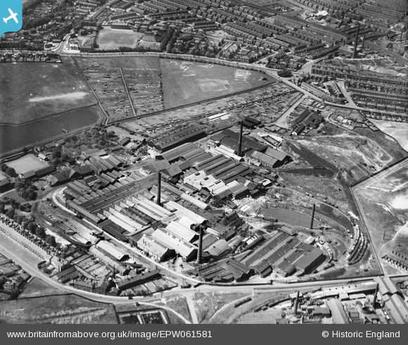
EPW061581 ENGLAND (1939). The Ravenhead Glass Works, St Helens, 1939
© Copyright OpenStreetMap contributors and licensed by the OpenStreetMap Foundation. 2024. Cartography is licensed as CC BY-SA.
Nearby Images (23)
EPW061581

EAW012379

EPW061592

EAW012374

EPW061588

EPW009305A

EPW009308

EPW009305

EAW012378

EPW061591

EPW061590

EPW009307

EAW012373

EPW009303

EPW061584

EPW061593

EPW061582

EPW009304

EPW061589

EAW012377

EPW061583

EAW012376

EAW012375

Details
| Title | [EPW061581] The Ravenhead Glass Works, St Helens, 1939 |
| Reference | EPW061581 |
| Date | 4-June-1939 |
| Link | |
| Place name | ST HELENS |
| Parish | |
| District | |
| Country | ENGLAND |
| Easting / Northing | 350136, 394525 |
| Longitude / Latitude | -2.7508330445439, 53.444875072483 |
| National Grid Reference | SJ501945 |
Pins
 Matt Aldred edob.mattaldred.com |
Thursday 7th of March 2024 02:03:40 PM | |
Matt Aldred edob.mattaldred.com |
Thursday 7th of March 2024 02:03:31 PM | |
 austin |
Friday 14th of February 2020 09:07:12 AM | |
pauloyick |
Thursday 2nd of January 2014 03:21:44 PM | |
pauloyick |
Thursday 2nd of January 2014 03:20:30 PM |


