
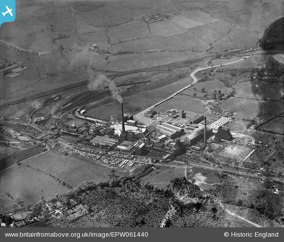
EPW061440 ENGLAND (1939). Chatterley Whitfield Colliery, Whitfield, 1939. This image has been produced froma damaged negative.
© Copyright OpenStreetMap contributors and licensed by the OpenStreetMap Foundation. 2024. Cartography is licensed as CC BY-SA.
Nearby Images (8)
EPW061440

EPW061438

EPW061439

EPW061443

EPW061436

EPW061445

EPW061442

EPW061437

Details
| Title | [EPW061440] Chatterley Whitfield Colliery, Whitfield, 1939. This image has been produced froma damaged negative. |
| Reference | EPW061440 |
| Date | 1-June-1939 |
| Link | |
| Place name | WHITFIELD |
| Parish | |
| District | |
| Country | ENGLAND |
| Easting / Northing | 388261, 353332 |
| Longitude / Latitude | -2.1752488061787, 53.076787717835 |
| National Grid Reference | SJ883533 |
Pins
 paul |
Thursday 5th of February 2015 05:01:49 PM | |
paul |
Thursday 5th of February 2015 05:01:09 PM | |
paul |
Thursday 5th of February 2015 05:00:14 PM | |
 bescotbeast |
Friday 13th of September 2013 11:49:50 AM |


