
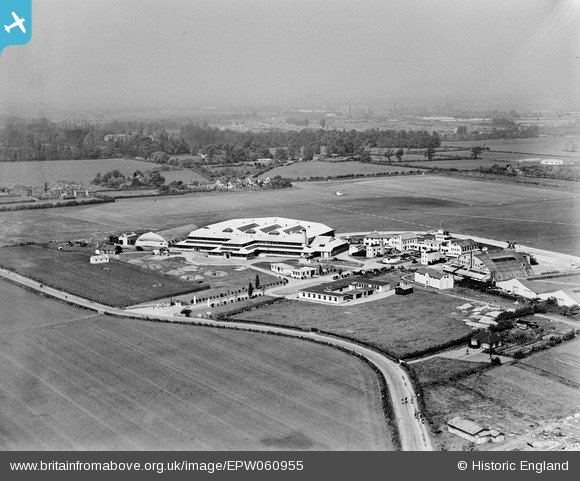
EPW060955 ENGLAND (1939). Hangars and terminal buildings at Heston Airport, Heston, from the south-east, 1939
© Copyright OpenStreetMap contributors and licensed by the OpenStreetMap Foundation. 2024. Cartography is licensed as CC BY-SA.
Nearby Images (48)
EPW037341

EPW033765

EPW037989

EPW028213

EPW037939

EPW061093

EPW037338

EPW028211

EPW037937

EPW033771

EPW028210

EPW040954

EPW044693

EPW028592

EPW038203

EPW044699

EPW038204

EPW044698

EPW056593

EPW033761

EPW035531

EPW044696

EPW031395

EPW031397

EPW031394

EPW060377

EPW031393

EPW037902

EPW037901

EPW037585

EPW038207

EPW037586

EPW040090

EPW037523

EPW040092

EPW040094

EPW037933

EPW060375

EPW034842
 after completing her world solo flight, 1931")
EPW040089

EPW037522

EPW053980

EPW036080

EPW038201

EPW038205

EPW031396

EPW037941

EPW033759

Details
| Title | [EPW060955] Hangars and terminal buildings at Heston Airport, Heston, from the south-east, 1939 |
| Reference | EPW060955 |
| Date | 12-May-1939 |
| Link | |
| Place name | HESTON |
| Parish | |
| District | |
| Country | ENGLAND |
| Easting / Northing | 511405, 177445 |
| Longitude / Latitude | -0.39537905060649, 51.484485563009 |
| National Grid Reference | TQ114774 |


