
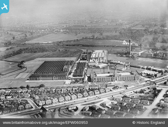
EPW060953 ENGLAND (1939). The Imperial Biscuit Works, Gillette Factory and environs, Osterley, 1939
© Copyright OpenStreetMap contributors and licensed by the OpenStreetMap Foundation. 2024. Cartography is licensed as CC BY-SA.
Nearby Images (16)
EPW060953

EPW059345

EAW050745

EAW050744

EPW034932

EPW040960

EPW034933

EPW040958

EPW022998

EAW050743

EAW050742

EPW031986

EPW032161

EAW050739

EPW051810

EPW034934

Details
| Title | [EPW060953] The Imperial Biscuit Works, Gillette Factory and environs, Osterley, 1939 |
| Reference | EPW060953 |
| Date | 12-May-1939 |
| Link | |
| Place name | OSTERLEY |
| Parish | |
| District | |
| Country | ENGLAND |
| Easting / Northing | 516241, 177757 |
| Longitude / Latitude | -0.32565234864067, 51.486316550942 |
| National Grid Reference | TQ162778 |
Pins
 Wordy |
Sunday 4th of May 2014 08:44:08 AM |


