
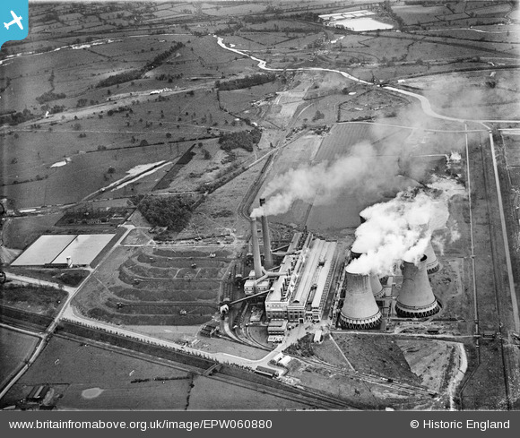
EPW060880 ENGLAND (1939). Hams Hall Power Station, Curdworth, 1939
© Copyright OpenStreetMap contributors and licensed by the OpenStreetMap Foundation. 2024. Cartography is licensed as CC BY-SA.
Nearby Images (27)
EPW060880

EPW060883

EPW023690

EAW021642

EPW060884

EPW023694

EPW060885

EPW023686

EPW023691

EPW023688

EPW060876

EAW021643

EPW023680

EPW060886

EPW060878

EPW060882

EPW023682

EPW023683

EPW023687

EAW021639

EPW023684

EPW023692

EPW060872

EPW023685

EPW023681

EPW060879

EAW021645

Details
| Title | [EPW060880] Hams Hall Power Station, Curdworth, 1939 |
| Reference | EPW060880 |
| Date | April-1939 |
| Link | |
| Place name | CURDWORTH |
| Parish | CURDWORTH |
| District | |
| Country | ENGLAND |
| Easting / Northing | 419480, 291964 |
| Longitude / Latitude | -1.7128461846688, 52.524838232719 |
| National Grid Reference | SP195920 |
Pins
Be the first to add a comment to this image!


