
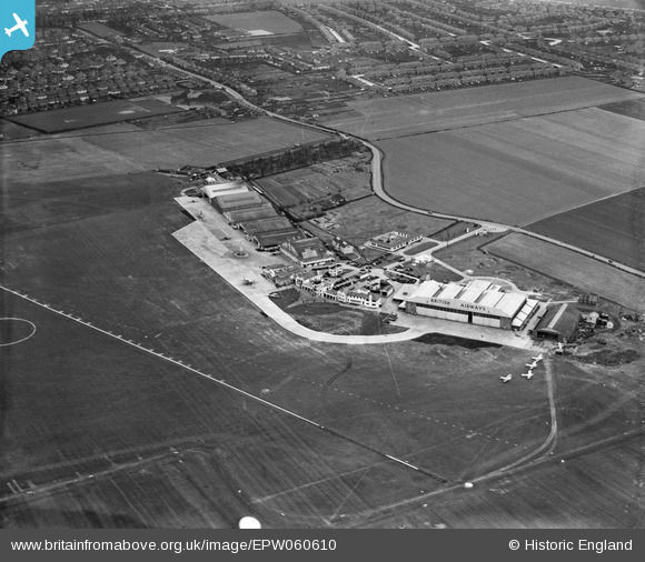
EPW060610 ENGLAND (1939). Hangars and terminal buildings at Heston Airport, Heston, 1939
© Copyright OpenStreetMap contributors and licensed by the OpenStreetMap Foundation. 2024. Cartography is licensed as CC BY-SA.
Nearby Images (48)
EPW031393

EPW037586

EPW040094

EPW038207

EPW028210

EPW044693

EPW033771

EPW031395

EPW037522

EPW040090

EPW037933

EPW036078

EPW061093

EPW040089

EPW028591

EPW028592

EPW037989

EPW031394

EPW038201

EPW044699

EPW053980

EPW037338

EPW037937

EPW038205

EPW037938

EPW037902

EPW037936

EPW036080

EPW038204

EPW060377

EPW037901

EPW028213

EPW060375

EPW033767

EPW031397

EPW036120

EPW037941

EPW031396

EPW037939

EPW041419

EPW033759

EPW034901

EPW037940

EPW036079

EPW041420

EPW025552

EPW037993

EPW037992

Details
| Title | [EPW060610] Hangars and terminal buildings at Heston Airport, Heston, 1939 |
| Reference | EPW060610 |
| Date | 2-March-1939 |
| Link | |
| Place name | HESTON |
| Parish | |
| District | |
| Country | ENGLAND |
| Easting / Northing | 511357, 177640 |
| Longitude / Latitude | -0.3960086135317, 51.486247873772 |
| National Grid Reference | TQ114776 |


