
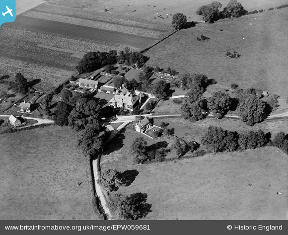
EPW059681 ENGLAND (1938). Restrop House, Restrop, 1938
© Copyright OpenStreetMap contributors and licensed by the OpenStreetMap Foundation. 2024. Cartography is licensed as CC BY-SA.
Nearby Images (3)
EPW059681

EPW059683

EPW059680

Details
| Title | [EPW059681] Restrop House, Restrop, 1938 |
| Reference | EPW059681 |
| Date | 29-September-1938 |
| Link | |
| Place name | RESTROP |
| Parish | PURTON |
| District | |
| Country | ENGLAND |
| Easting / Northing | 408130, 186886 |
| Longitude / Latitude | -1.8826569300066, 51.580302219557 |
| National Grid Reference | SU081869 |
Pins
Katy Whitaker |
Saturday 30th of August 2014 09:21:44 PM | |
 totoro |
Wednesday 19th of February 2014 03:32:07 PM | |
totoro |
Wednesday 15th of January 2014 08:45:20 PM | |
totoro |
Wednesday 15th of January 2014 08:44:53 PM | |
totoro |
Wednesday 15th of January 2014 08:44:31 PM | |
totoro |
Wednesday 15th of January 2014 08:43:54 PM | |
totoro |
Wednesday 15th of January 2014 08:43:30 PM |
User Comment Contributions
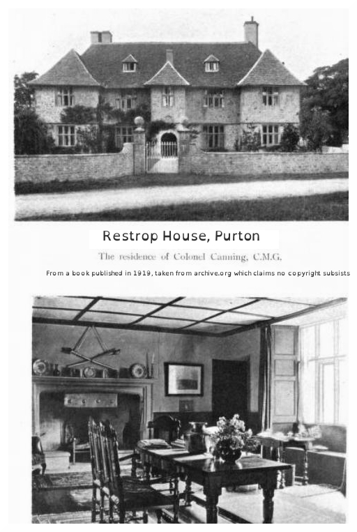 Image of house exterior and hall, c 1919 taken from archive.org "The Story of Purton" by Ethel Richardson. Claimed by archive.org to be no copyright. Book from University of California. |
totoro |
Wednesday 15th of January 2014 08:54:03 PM |


