
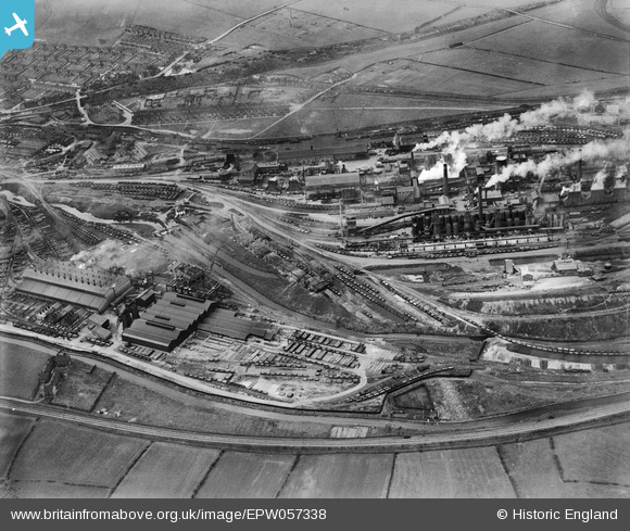
EPW057338 ENGLAND (1938). The Staveley Coal and Iron Company Ltd Works, Staveley, 1938
© Copyright OpenStreetMap contributors and licensed by the OpenStreetMap Foundation. 2024. Cartography is licensed as CC BY-SA.
Nearby Images (13)
EPW057338

EAW044349

EPW057354

EPW057343

EPW041673

EPW041677

EAW043846

EAW003066

EPW041682

EAW003061

EPW041678

EPW041681

EPW041679

Details
| Title | [EPW057338] The Staveley Coal and Iron Company Ltd Works, Staveley, 1938 |
| Reference | EPW057338 |
| Date | 3-June-1938 |
| Link | |
| Place name | STAVELEY |
| Parish | STAVELEY |
| District | |
| Country | ENGLAND |
| Easting / Northing | 442136, 374780 |
| Longitude / Latitude | -1.3681543659961, 53.268059353822 |
| National Grid Reference | SK421748 |
Pins
Be the first to add a comment to this image!


