
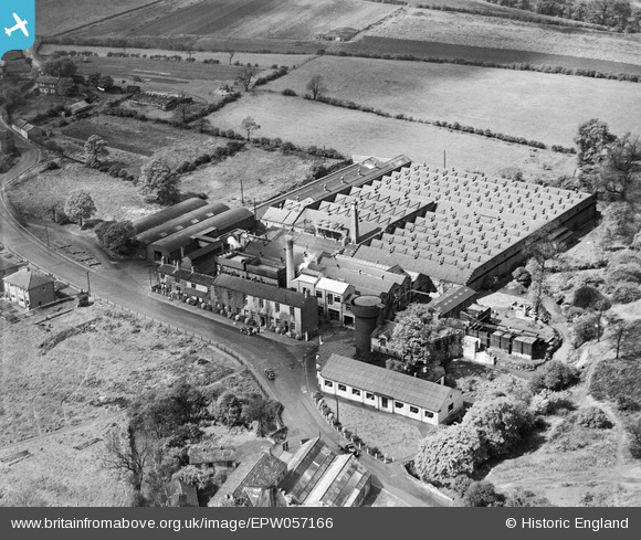
EPW057166 ENGLAND (1938). The Troydale Woollen Mill, Pudsey, 1938
© Copyright OpenStreetMap contributors and licensed by the OpenStreetMap Foundation. 2024. Cartography is licensed as CC BY-SA.
Nearby Images (6)
EPW057166

EPW057165

EPW057161

EPW057162

EPW057163

EPW057164

Details
| Title | [EPW057166] The Troydale Woollen Mill, Pudsey, 1938 |
| Reference | EPW057166 |
| Date | 24-May-1938 |
| Link | |
| Place name | PUDSEY |
| Parish | |
| District | |
| Country | ENGLAND |
| Easting / Northing | 423888, 432472 |
| Longitude / Latitude | -1.6373791162914, 53.787802555483 |
| National Grid Reference | SE239325 |
Pins
Be the first to add a comment to this image!


