
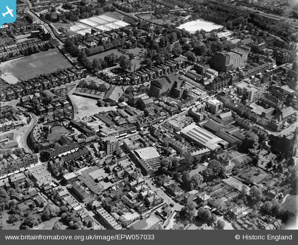
EPW057033 ENGLAND (1938). The High Street, Sutton, 1938
© Copyright OpenStreetMap contributors and licensed by the OpenStreetMap Foundation. 2024. Cartography is licensed as CC BY-SA.
Nearby Images (24)
EPW057033

EPW001674

EPW028245

EPW028239

EPW050017

EAW022945

EAW022940

EAW022944

EAW022954

EAW022946

EAW022943

EAW022958

EAW022941

EAW022957
 on Lenham Road and the High Street, Sutton, 1949")
EAW022956

EPW057032

EPW028249

EAW022955

EAW022942

EPW057037

EPW011427

EPW011420

EPW006398

EPW011424

Details
| Title | [EPW057033] The High Street, Sutton, 1938 |
| Reference | EPW057033 |
| Date | 5-May-1938 |
| Link | |
| Place name | SUTTON |
| Parish | |
| District | |
| Country | ENGLAND |
| Easting / Northing | 525910, 164262 |
| Longitude / Latitude | -0.19124735711439, 51.362951327063 |
| National Grid Reference | TQ259643 |
Pins
 christhewino |
Wednesday 23rd of February 2022 09:11:57 AM | |
christhewino |
Monday 15th of July 2013 07:56:06 PM | |
christhewino |
Monday 15th of July 2013 07:55:48 PM |


