
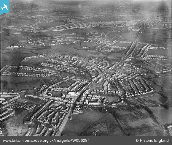
EPW056284 ENGLAND (1938). Greenford Road and environs, Greenford, from the south, 1938
© Copyright OpenStreetMap contributors and licensed by the OpenStreetMap Foundation. 2024. Cartography is licensed as CC BY-SA.
Nearby Images (12)
EPW056284

EPW056276

EPW056277

EPW020328

EPW056274

EPR000617

EPW056273

EPW056286

EPW020330

EPW020330
EPW020326

EPW020325

Details
| Title | [EPW056284] Greenford Road and environs, Greenford, from the south, 1938 |
| Reference | EPW056284 |
| Date | 17-January-1938 |
| Link | |
| Place name | GREENFORD |
| Parish | |
| District | |
| Country | ENGLAND |
| Easting / Northing | 514453, 182129 |
| Longitude / Latitude | -0.34997612538204, 51.525980218424 |
| National Grid Reference | TQ145821 |
Pins
 The Laird |
Thursday 28th of February 2019 02:38:18 PM |


