
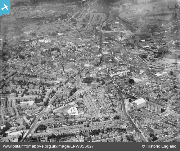
EPW055027 ENGLAND (1937). The city, Derby, from the south-east, 1937
© Copyright OpenStreetMap contributors and licensed by the OpenStreetMap Foundation. 2024. Cartography is licensed as CC BY-SA.
Nearby Images (11)
EPW055027

EPW057156

EPW057154

EPW057155

EAW004652

EAW004655

EAW004654

EPW005814

EAW004657

EPW055022

EPW041814

Details
| Title | [EPW055027] The city, Derby, from the south-east, 1937 |
| Reference | EPW055027 |
| Date | August-1937 |
| Link | |
| Place name | DERBY |
| Parish | |
| District | |
| Country | ENGLAND |
| Easting / Northing | 435312, 335715 |
| Longitude / Latitude | -1.4747714770973, 52.917375175385 |
| National Grid Reference | SK353357 |
Pins
 aremla |
Saturday 16th of December 2023 04:59:02 PM | |
aremla |
Saturday 16th of December 2023 04:57:40 PM | |
HelsyB |
Sunday 3rd of September 2023 04:24:44 PM | |
HelsyB |
Sunday 3rd of September 2023 04:22:00 PM | |
HelsyB |
Sunday 3rd of September 2023 04:20:55 PM |


