
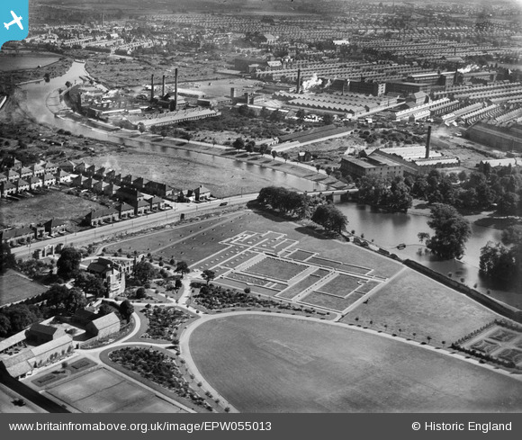
EPW055013 ENGLAND (1937). Leicester Abbey, Leicester, 1937
© Copyright OpenStreetMap contributors and licensed by the OpenStreetMap Foundation. 2024. Cartography is licensed as CC BY-SA.
Nearby Images (13)
EPW055013

EAW024251
 and the site of Leicester Abbey, Leicester, 1949")
EAW043362

EPW047639

EAW024250
 and the site of Leicester Abbey, Leicester, 1949")
EAW010418

EAW010423

EPW047640

EAW010421

EAW051825

EAW010420

EAW010416

EAW024249
 and the site of Leicester Abbey, Leicester, 1949")
Details
| Title | [EPW055013] Leicester Abbey, Leicester, 1937 |
| Reference | EPW055013 |
| Date | August-1937 |
| Link | |
| Place name | LEICESTER |
| Parish | |
| District | |
| Country | ENGLAND |
| Easting / Northing | 458582, 306078 |
| Longitude / Latitude | -1.1339953334801, 52.648919029865 |
| National Grid Reference | SK586061 |
Pins
Be the first to add a comment to this image!


