
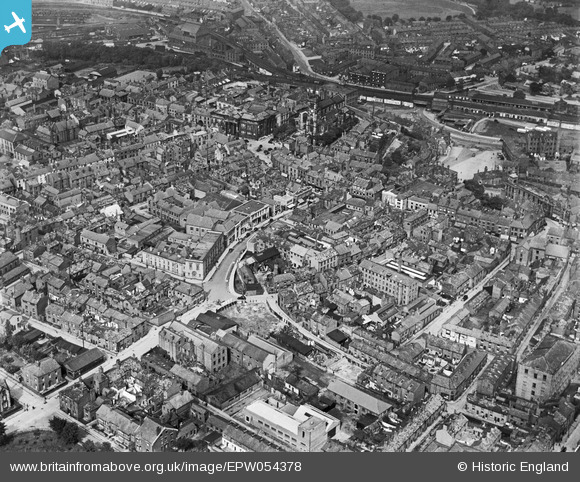
EPW054378 ENGLAND (1937). Castle Street, St Michael's Church and the town centre, Macclesfield, 1937
© Copyright OpenStreetMap contributors and licensed by the OpenStreetMap Foundation. 2024. Cartography is licensed as CC BY-SA.
Nearby Images (18)
EPW054378

EPW057639

EPW054380

EPW016737

EPW057374

EPW054374

EPW054375

EPW057375

EPW054379

EPW057641

EPW050709
, the Marlborough Mill and the John Clayton Ltd Timber Yard, Macclesfield, 1936. This image has been affected by flare.")
EPW050707
, the Marlborough Mill and the John Clayton Ltd Timber Yard, Macclesfield, 1936")
EPW057636

EPW050706
, the Marlborough Mill and the John Clayton Ltd Timber Yard, Macclesfield, 1936")
EPW050708
, the Marlborough Mill and the John Clayton Ltd Timber Yard, Macclesfield, 1936")
EPW050716

EPW050713

EPW050714

Details
| Title | [EPW054378] Castle Street, St Michael's Church and the town centre, Macclesfield, 1937 |
| Reference | EPW054378 |
| Date | 20-July-1937 |
| Link | |
| Place name | MACCLESFIELD |
| Parish | |
| District | |
| Country | ENGLAND |
| Easting / Northing | 391624, 373617 |
| Longitude / Latitude | -2.1255747485296, 53.259212020758 |
| National Grid Reference | SJ916736 |


