
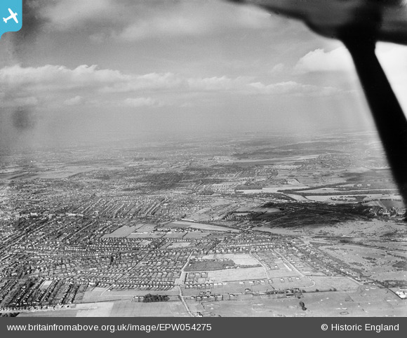
EPW054275 ENGLAND (1937). An infrared photograph of Sutton and Carshalton, Sutton, from the south-west, 1937
© Copyright OpenStreetMap contributors and licensed by the OpenStreetMap Foundation. 2024. Cartography is licensed as CC BY-SA.
Details
| Title | [EPW054275] An infrared photograph of Sutton and Carshalton, Sutton, from the south-west, 1937 |
| Reference | EPW054275 |
| Date | 13-July-1937 |
| Link | |
| Place name | SUTTON |
| Parish | |
| District | |
| Country | ENGLAND |
| Easting / Northing | 524855, 162157 |
| Longitude / Latitude | -0.20713376463569, 51.344263835122 |
| National Grid Reference | TQ249622 |
Pins
 christhewino |
Thursday 12th of January 2023 10:47:55 PM | |
christhewino |
Monday 9th of January 2023 11:47:30 AM | |
christhewino |
Monday 9th of January 2023 11:17:22 AM | |
christhewino |
Monday 9th of January 2023 11:16:05 AM | |
christhewino |
Monday 9th of January 2023 11:15:00 AM | |
christhewino |
Monday 9th of January 2023 11:14:42 AM | |
christhewino |
Monday 9th of January 2023 09:52:17 AM | |
christhewino |
Monday 9th of January 2023 09:51:48 AM | |
 Ferrers |
Monday 12th of December 2022 04:41:48 PM |


