
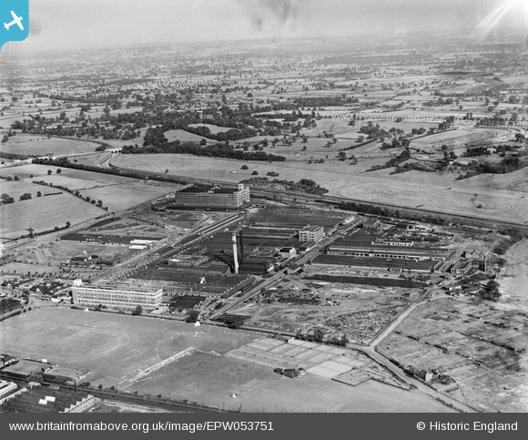
EPW053751 ENGLAND (1937). The Fort Dunlop Rubber Works, Bromford, from the west, 1937
© Copyright OpenStreetMap contributors and licensed by the OpenStreetMap Foundation. 2024. Cartography is licensed as CC BY-SA.
Nearby Images (14)
EPW053751

EPW026938

EPW026935

EPW001206

EPW053752

EPW026936

EPW026941

EPW026940

EPW026943

EPW026933

EPW026934

EPW026937

EPW022581

EPW055212

Details
| Title | [EPW053751] The Fort Dunlop Rubber Works, Bromford, from the west, 1937 |
| Reference | EPW053751 |
| Date | June-1937 |
| Link | |
| Place name | BROMFORD |
| Parish | |
| District | |
| Country | ENGLAND |
| Easting / Northing | 412274, 290417 |
| Longitude / Latitude | -1.8191258931335, 52.511139333393 |
| National Grid Reference | SP123904 |
Pins
 frothy |
Thursday 8th of November 2018 08:14:08 PM | |
frothy |
Thursday 8th of November 2018 08:12:51 PM | |
 Griffin |
Friday 30th of October 2015 02:04:58 PM | |
Griffin |
Friday 30th of October 2015 01:55:59 PM | |
gerry-r |
Saturday 3rd of January 2015 09:34:04 PM | |
Martin |
Monday 30th of December 2013 07:07:44 PM |


