
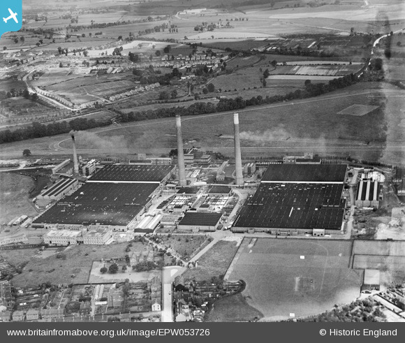
EPW053726 ENGLAND (1937). The Dunstall Hall Art Silk Works, Wolverhampton, 1937
© Copyright OpenStreetMap contributors and licensed by the OpenStreetMap Foundation. 2024. Cartography is licensed as CC BY-SA.
Nearby Images (16)
EPW053726

EPW024562

EPW024561

EAW038026

EPW024563

EPW024557

EPW022577

EPW024559

EPW024564

EPW021055

EPW021053

EPW021054

EPW024558

EPW015219

EAW038022

EPW021052

Details
| Title | [EPW053726] The Dunstall Hall Art Silk Works, Wolverhampton, 1937 |
| Reference | EPW053726 |
| Date | June-1937 |
| Link | |
| Place name | WOLVERHAMPTON |
| Parish | |
| District | |
| Country | ENGLAND |
| Easting / Northing | 390191, 300329 |
| Longitude / Latitude | -2.1448422827754, 52.600306713606 |
| National Grid Reference | SJ902003 |
Pins
 Rob |
Monday 8th of February 2016 06:37:13 PM | |
Rob |
Monday 8th of February 2016 06:35:57 PM | |
Rob |
Monday 8th of February 2016 06:34:43 PM | |
Rob |
Monday 8th of February 2016 06:34:08 PM | |
Rob |
Sunday 7th of February 2016 06:32:25 PM | |
Rob |
Friday 5th of February 2016 10:08:34 PM | |
Rob |
Friday 5th of February 2016 09:55:32 PM |


