
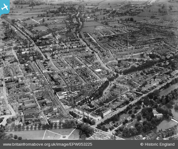
EPW053225 ENGLAND (1937). The town, Royal Leamington Spa, from the south-west, 1937
© Copyright OpenStreetMap contributors and licensed by the OpenStreetMap Foundation. 2024. Cartography is licensed as CC BY-SA.
Nearby Images (17)
EPW053225

EPW001214

EPW005093

EPW005096

EPW005091

EPW001219

EAW003636

EPW005097

EPW053222

EAW003637

EPW005092

EPW053226

EPW001215

EPW005095

EAW024685

EAW024683

EPW053219

Details
| Title | [EPW053225] The town, Royal Leamington Spa, from the south-west, 1937 |
| Reference | EPW053225 |
| Date | 24-May-1937 |
| Link | |
| Place name | ROYAL LEAMINGTON SPA |
| Parish | ROYAL LEAMINGTON SPA |
| District | |
| Country | ENGLAND |
| Easting / Northing | 431863, 265754 |
| Longitude / Latitude | -1.5328104686338, 52.288605302074 |
| National Grid Reference | SP319658 |
Pins
 Glassman |
Tuesday 8th of April 2014 04:37:51 PM | |
Glassman |
Tuesday 8th of April 2014 04:37:08 PM | |
Glassman |
Tuesday 8th of April 2014 04:34:42 PM | |
 |
Glassman |
Tuesday 8th of April 2014 02:56:00 PM |


