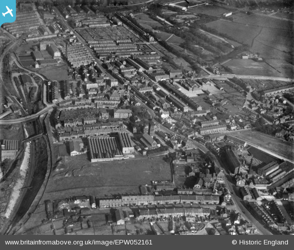
EPW052161 ENGLAND (1936). Great Horton and Little Horton, Bradford, 1936. This image has been produced from a print.

© Copyright OpenStreetMap contributors and licensed by the OpenStreetMap Foundation. 2024. Cartography is licensed as CC BY-SA.

Nearby Images (10)

EPW052161
  0° 0m
EPW024410
  276° 117m
EAW009135
  328° 225m
EAW009132
  314° 291m
EAW009130
  310° 305m
EAW009136
  316° 305m
EAW009131
  315° 309m
EAW009128
  316° 328m
EAW009133
  317° 335m
EAW009129
  315° 341m

Details

Title [EPW052161] Great Horton and Little Horton, Bradford, 1936. This image has been produced from a print.
Reference EPW052161
Date October-1936
Link
Place name BRADFORD
Parish
District
Country ENGLAND
Easting / Northing 414262, 431662
Longitude / Latitude -1.7835381591837, 53.780874314895
National Grid Reference SE143317

Pins

Fading memory - I think this was a covered barn like shelter for the infants and girls. There was a similar one in the boys playground, no staying inside just because it was cold or raining!

RichardN
Monday 11th of May 2020 10:07:34 PM
Old air raid shelters in the school playground. Demolished in the late sixties I think.

RichardN
Monday 11th of May 2020 10:02:58 PM
Woodwork Block - boys only

RichardN
Monday 11th of May 2020 10:01:37 PM
The Park Keeper's house.

H.J.Hill
Friday 2nd of June 2017 07:22:07 PM
The Tide Field - rough ground which accommodated a travelling fair twice each year, and otherwise stood empty.

H.J.Hill
Friday 2nd of June 2017 07:19:12 PM
Don't forget it was also used as a site for one the many bonfires in Great Horton - seem to remember loads of wicker skips or baskets being burnt as the mills shut down in the 1960s

RichardN
Monday 11th of May 2020 09:50:46 PM

H.J.Hill
Friday 2nd of June 2017 07:17:52 PM
The Apostolic Church - a corrugated tin-shack mission hall.

H.J.Hill
Friday 2nd of June 2017 07:16:59 PM
Bethel Chapel's Sunday School building. The primary school on Southfield Lane (Bell School) housed class 3A there from Sept 1956 to July 1957 with Miss Moore. The baby boom was referred to as the 'bulge' by those in education! There were 40+ children in the class.

H.J.Hill
Friday 2nd of June 2017 07:15:55 PM
I was one of the boomers - moved there as overspill from the Bell School as you said. I was briefly at a nursery adjacent to Cross lane school but when I moved up to the Bell School, it was to here but then the rest of my time was in the main school - Brian Clarke was the Headteacher then, Mrs Styche and another young lady teacher Miss Burns? taught me.

RichardN
Monday 11th of May 2020 09:56:51 PM
Bethel Chapel - now a green area at the junction of Arctic Parade - Cross Lane with Gt Horton Rd.

H.J.Hill
Friday 2nd of June 2017 07:11:59 PM
Hunt Yard - the correct location

H.J.Hill
Friday 2nd of June 2017 07:10:34 PM
The coal drops - rail wagons dropped coal in at the top, coal dealers loaded sacks at the bottom.

H.J.Hill
Friday 2nd of June 2017 07:08:50 PM
The Grange cinema - still stuck in the 1920s in the 1950s!

H.J.Hill
Friday 2nd of June 2017 07:06:34 PM
Pedestrian access to Great Horton Railway station through an opening in the road bridge - iron framework steps led down to a lower footbridge that connected the platforms. It was scary!

H.J.Hill
Friday 2nd of June 2017 10:37:24 AM
The Bell Chapel - built as a chapel of ease and later replaced by St John's church - this housed the school hall (with chapel galleries removed) and one classroom for the adjacent National/junior school.

H.J.Hill
Friday 2nd of June 2017 10:34:48 AM
The Emporium - head quarters and department store of the Great Horton Industrial Society (Great Horton Coop).

H.J.Hill
Friday 2nd of June 2017 10:32:18 AM
Hudson Avenue. This 'extension' to Cross Lane runs into Southfield Lane and sort of made Cross Lane less well used except for residents.

chrisrob
Sunday 14th of May 2017 07:31:41 PM
Recreation ground, 3 full sized football pitches-still there where we used to play as kids with jumpers for goalposts-you know the rest.

chrisrob
Sunday 14th of May 2017 07:29:10 PM
Allotments-my grandad had one here

chrisrob
Sunday 14th of May 2017 07:26:35 PM
Sowden Street. My grandad lived at No 39 for more than 50 years.

chrisrob
Sunday 14th of May 2017 07:25:16 PM
Halstead Place.

chrisrob
Sunday 14th of May 2017 07:23:07 PM
Allotments for the locals - what a good idea they were.

chrisrob
Sunday 14th of May 2017 07:22:11 PM
Cecil Avenue. A cut above in the day. Large terraced houses with servants, broad tree-lined road, overlooking the park to the rear.

chrisrob
Sunday 14th of May 2017 07:20:24 PM
Nutter Orphanage for boys. Various uses since but now alas empty.

chrisrob
Sunday 14th of May 2017 07:16:34 PM
Great Horton Park top pond. There's a bench mark carved into the perimeter wall which is 574.6 Ft above sea level (or was in 1895!) Note: picture is of bottom boating lake . No pic of top pond

chrisrob
Sunday 14th of May 2017 07:15:52 PM
Bradford Park Avenue football ground. Division 3 they were in when I watched them in the late fifties. Great rivalry with the 'City' supporters.

chrisrob
Sunday 14th of May 2017 07:09:58 PM
Cricket Ground, I watched Yorkshire-Fred Trueman etc. play here during those long hot school holiday summers mid late fifties.

chrisrob
Sunday 14th of May 2017 07:07:51 PM
Around here is Hunt Yard. So named as the yard was given as a prize to the person who slayed the wild boar terrorising people in the Bolton Woods area in medieval times and this is why there's a boar on the Bfd coat of arms. See pic. It is now old folks housing.

chrisrob
Sunday 14th of May 2017 07:02:21 PM
Jennings Place

chrisrob
Sunday 14th of May 2017 06:46:39 PM
Melrose Street

chrisrob
Sunday 14th of May 2017 06:45:36 PM
Pleasant Street

chrisrob
Sunday 14th of May 2017 06:44:35 PM
Gathorne Street (often spelt-and we pronounced it as Gaythorne Street) Part of this street was pulled down stone by stone, reassembled and can be seen at the Bradford Industrial Museum on Moorside Rd, Bradford Moor.

chrisrob
Sunday 14th of May 2017 06:43:03 PM
These streets were built as a mini-Saltaire by the owner of Union Rd Mills (where the chimney is). The street names-from the nearest to the camera are Lime, Hart, Vine and Falcon and then Union Road

chrisrob
Sunday 14th of May 2017 06:39:31 PM
Harris Court Mill (later Courtaulds) with owner's house and flat gardens behind. Now working men's club

chrisrob
Sunday 14th of May 2017 06:35:29 PM
Kingswood House, note grounds to rear in Kingswood Square where there was an communal air raid shelter (held around 300) until at least 1970.

chrisrob
Sunday 14th of May 2017 06:28:14 PM
Westcroft (Rd) Mill, where I worked as maintenance plumber 1969.

chrisrob
Sunday 14th of May 2017 06:20:51 PM
Cross Lane Library-wonderful Grade 2 listed building. Stupidly sold by auction for £125K by Bradford Council 23/7/13 and has lain empty and forlorn ever since.

chrisrob
Sunday 14th of May 2017 05:40:14 PM
Bakes Street Congregational Chapel

chrisrob
Sunday 14th of May 2017 05:32:39 PM

chrisrob
Sunday 14th of May 2017 05:31:40 PM
St John's Church

chrisrob
Sunday 14th of May 2017 05:30:14 PM
Old Corn Mill Lane.

chrisrob
Sunday 14th of May 2017 05:29:36 PM
Cousen Rd. Entrance to Gt Horton Park

chrisrob
Sunday 14th of May 2017 05:27:25 PM
Cross Lane Secondary Modern School (left), Cross Lane Infants (right)

chrisrob
Sunday 14th of May 2017 05:26:07 PM
Brooksbank House,1600's. (Cudworth, Rambles around Horton)

chrisrob
Sunday 14th of May 2017 05:24:18 PM
21 Kingswood Street, where I grew up.

chrisrob
Sunday 14th of May 2017 05:22:28 PM