
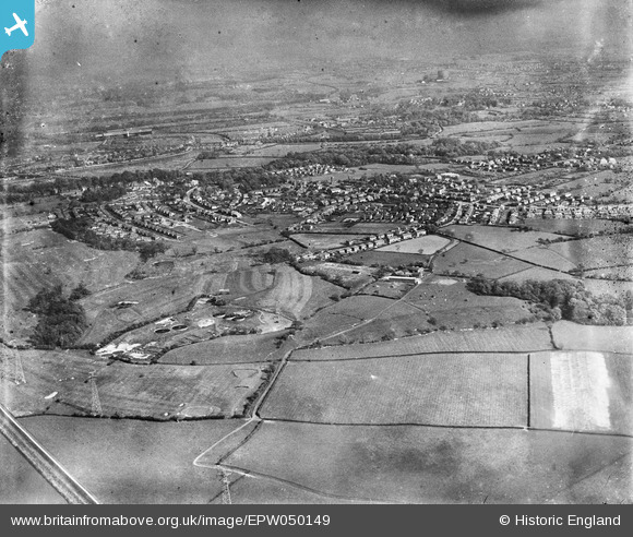
EPW050149 ENGLAND (1936). The Penwortham Sewage Works, the town and environs, Penwortham, from the north-west, 1936
© Copyright OpenStreetMap contributors and licensed by the OpenStreetMap Foundation. 2024. Cartography is licensed as CC BY-SA.
Nearby Images (2)
EPW050149

EPW050153

Details
| Title | [EPW050149] The Penwortham Sewage Works, the town and environs, Penwortham, from the north-west, 1936 |
| Reference | EPW050149 |
| Date | May-1936 |
| Link | |
| Place name | PENWORTHAM |
| Parish | PENWORTHAM |
| District | |
| Country | ENGLAND |
| Easting / Northing | 351032, 428892 |
| Longitude / Latitude | -2.7427419020716, 53.753868987883 |
| National Grid Reference | SD510289 |
Pins
Be the first to add a comment to this image!


