
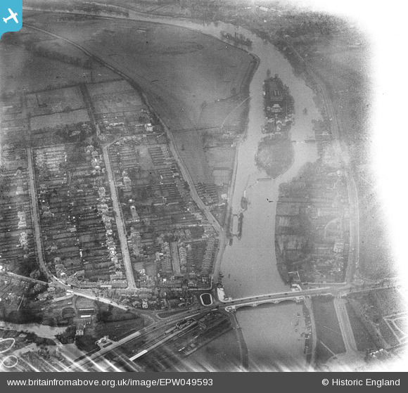
EPW049593 ENGLAND (1936). The River Thames at Hampton Court Bridge, Taggs Island and environs, East Molesey, 1936. This image has been affected by flare.
© Copyright OpenStreetMap contributors and licensed by the OpenStreetMap Foundation. 2024. Cartography is licensed as CC BY-SA.
Nearby Images (6)
EPW049593

EPW022850

EAW003673

EAW003674

EPW001714

EPW031570

Details
| Title | [EPW049593] The River Thames at Hampton Court Bridge, Taggs Island and environs, East Molesey, 1936. This image has been affected by flare. |
| Reference | EPW049593 |
| Date | January-1936 |
| Link | |
| Place name | EAST MOLESEY |
| Parish | |
| District | |
| Country | ENGLAND |
| Easting / Northing | 514962, 168660 |
| Longitude / Latitude | -0.34702267152219, 51.404806598408 |
| National Grid Reference | TQ150687 |
Pins
Be the first to add a comment to this image!


