
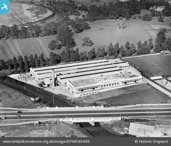
EPW049469 ENGLAND (1935). The Thompson and Norris Corrugated Cases Manufactory, Brentford, 1935
© Copyright OpenStreetMap contributors and licensed by the OpenStreetMap Foundation. 2024. Cartography is licensed as CC BY-SA.
Nearby Images (18)
EPW049469

EPW049468

EPW049472

EPW049471

EPW049467

EPW049473

EPW049470

EPW034930

EPW057073

EPW057076

EPW057077

EPW034931

EPW057063

EPW057075

EPW031240

EAW050748

EAW050746

EPW031244

Details
| Title | [EPW049469] The Thompson and Norris Corrugated Cases Manufactory, Brentford, 1935 |
| Reference | EPW049469 |
| Date | October-1935 |
| Link | |
| Place name | BRENTFORD |
| Parish | |
| District | |
| Country | ENGLAND |
| Easting / Northing | 516885, 177871 |
| Longitude / Latitude | -0.31634265037402, 51.487208488808 |
| National Grid Reference | TQ169779 |
Pins
 Maurice |
Sunday 30th of June 2013 07:03:35 AM |


