
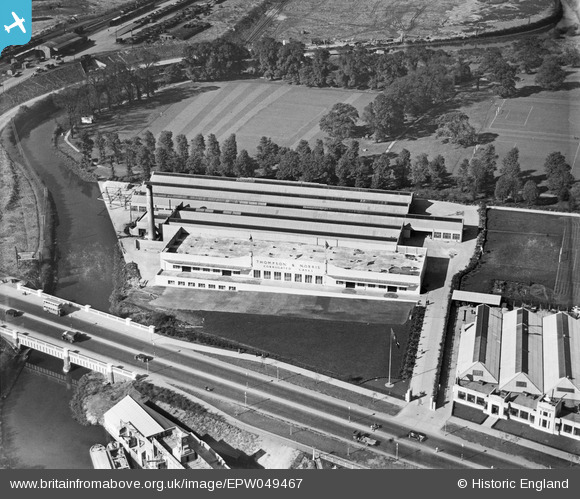
EPW049467 ENGLAND (1935). The Thompson and Norris Corrugated Cases Manufactory, Brentford, 1935
© Copyright OpenStreetMap contributors and licensed by the OpenStreetMap Foundation. 2024. Cartography is licensed as CC BY-SA.
Nearby Images (19)
EPW049467

EPW049472

EPW049471

EPW049473

EPW049470

EPW049468

EPW049469

EPW034930

EPW057073

EPW057076

EPW057077

EPW034931

EPW057075

EPW057074

EPW057063

EPW031240

EPW031243

EPW031244

EPW053244

Details
| Title | [EPW049467] The Thompson and Norris Corrugated Cases Manufactory, Brentford, 1935 |
| Reference | EPW049467 |
| Date | October-1935 |
| Link | |
| Place name | BRENTFORD |
| Parish | |
| District | |
| Country | ENGLAND |
| Easting / Northing | 516908, 177850 |
| Longitude / Latitude | -0.31601845859033, 51.487014971972 |
| National Grid Reference | TQ169779 |
Pins
Be the first to add a comment to this image!


